Smoke has arrived a couple of months early this summer season and here is how you can help your family protect themselves on days when air quality is poor.
That massive air conditioner in our back yard not only keeps us comfortable during the summer, but it kills off most of the severe storms capable of spinning up tornadoes. Cook County: take a bow. You are the most "tornado-safe" county in Minnesota.
But wait, there's more? As if 140" of snow isn't enough - models are hinting at more slushy possibilities in the coming days, especially over the Minnesota Arrowhead. Would someone please try to reboot spring?
The Twin Ports just set a new all-time winter snowfall record: more than 138" and the snow isn't over just yet. The freezing rain is over but more light snow will fall today and tonight.
High winds and rain freezing on contact may coat trees and highways with an icy coating today, before a changeover to snow tonight and Friday that should push the Twin Ports to a new, all-time snowfall record for the winter.
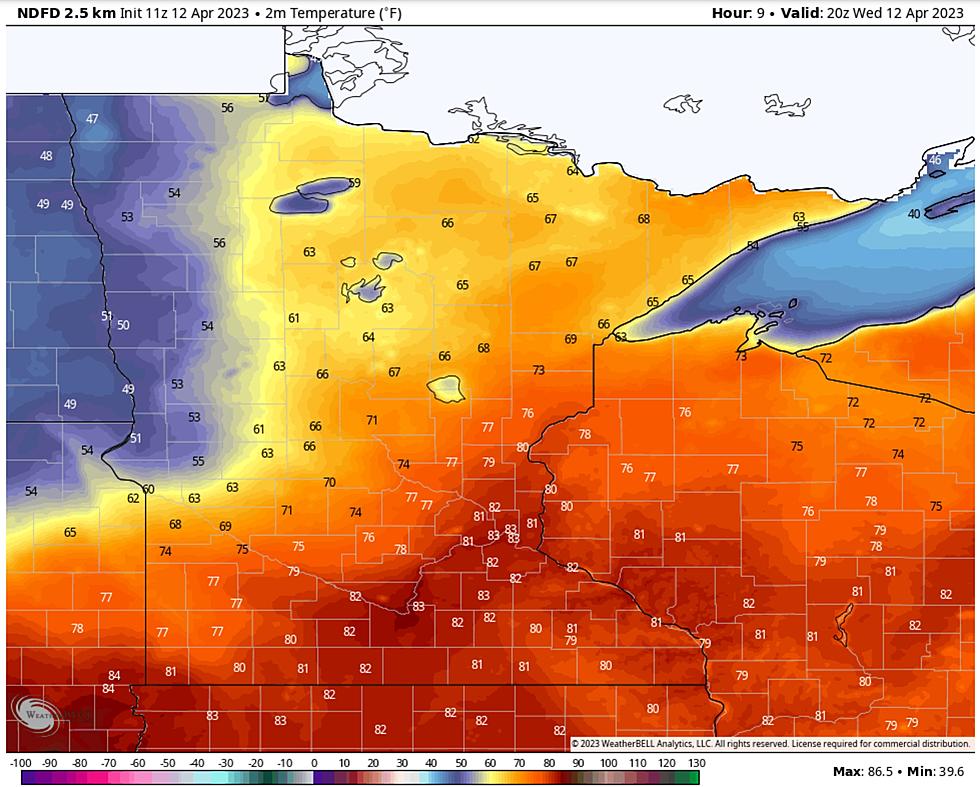
Welcome to a crazy week of weather whiplash with rapidly melting snow up north and fire weather in the south. Serious flooding is already taking place across the Northland as a near-record amount of water in the snowpack is flushed into streets and streams.
Rapid warming is triggering flooding over the South Shore of Lake Superior, and temperatures near 70F (inland) later today will accelerate runoff and flooding across much of the Northland. Cooler weather, and a little slush, is shaping up for the weekend.
Only in the Northland can you be ankle-deep in slush with a mild breeze blowing in your face. This week's rapid thaw is increasing hopes for spring, and the potential for significant flooding in the coming weeks.
Crazy weather extremes are shaping up for Minnesota and Wisconsin over the next week. From balmy 60s midweek to plowable snow next weekend, the 7-Day Outlook has something for everyone.