
Winter Storm Warning Issued For MN Arrowhead, Head Of The Lake
Hopefully you didn't bury those shovels and boots too deeply yet.
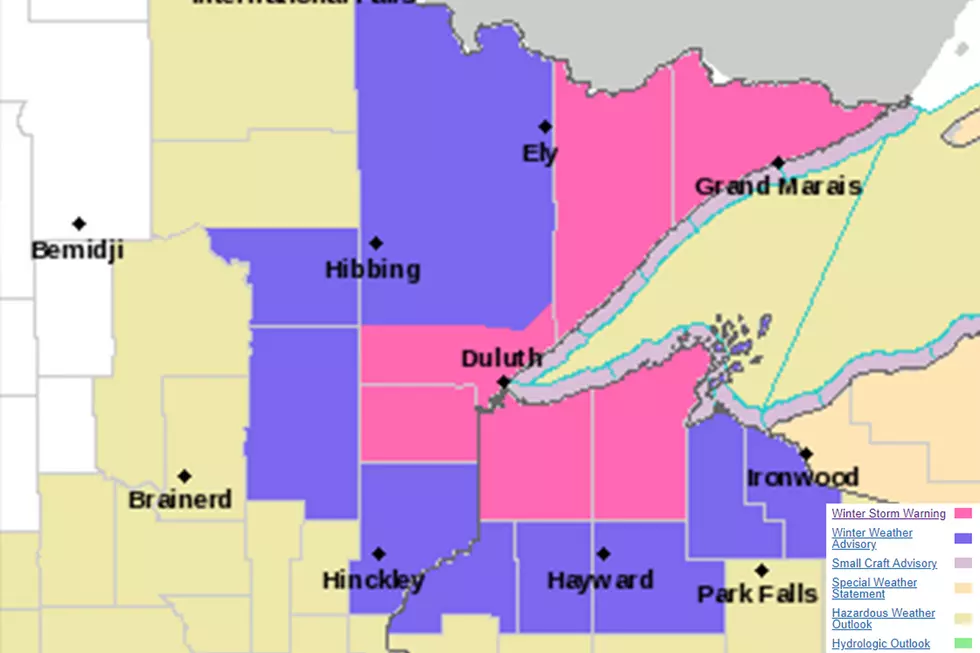
The National Weather Service has issued a winter storm warning for a spring storm that could bring 4-8 inches of snow to much of the warned area, and 6-10 inches to some higher terrains near Lake Superior overnight Wednesday into Thursday. That winter storm warning goes into effect at 7 pm Wednesday through 10 am Thursday, May 9.
Here's what the National Weather Service is saying:
A large system will cross Wisconsin tonight into Thursday bringing snowfall to northwest Wisconsin and northeast Minnesota. Due to the system arriving overnight, the warm May sun will not play much of a role in impeding snowfall accumulations; therefore, expect snowfall to rapidly accumulate during the overnight hours. There will be a rain/snow line across northwest Wisconsin where areas southeast of that line will only see rain and northwest of that line will see significant snowfall accumulations.
- WHAT - Heavy snow expected. Total snow accumulations of 4 to 8 inches, except 6 to 10 inches along the higher terrain surrounding Lake Superior.
- WHERE -
- Wisconsin: Douglas and Bayfield Counties. In
- Minnesota: Northern Cook and Lake, Southern Lake, Southern Cook and Carlton and South St. Louis Counties.
- WHEN - From 7 PM this evening to 10 AM CDT Thursday.
Travel could be very difficult. The hazardous conditions could impact the morning commute. There may be power outages due to the wet and heavy nature of the snow.
A Winter Storm Warning means significant amounts of snow, sleet and ice will make travel very hazardous or impossible.
More From Sasquatch 92.1 FM

